Log in
All resources
Create a design
134 Free Artworks of Maps Of Sweden
copper engraving print
joan blaeu
atlas maior, vol 2 (sweden, russia, poland, eastern europe, and greece) - joan blaeu, 1667 - bl 114.h(star).2
british library
old maps of the white sea
maps of the barents sea
dutch-language maps
baptista van doetecum
northern sea route
latin-language maps
third voyage of willem barentsz
16th-century maps of the arctic
third voyage of willem barentsz
history of dutch sea fisheries
third voyage of willem barentsz
history of dutch sea fisheries
third voyage of willem barentsz
16th-century maps of the arctic
third voyage of willem barentsz
16th-century maps of the arctic
the voyage of the vega round asia and europe
third voyage of willem barentsz
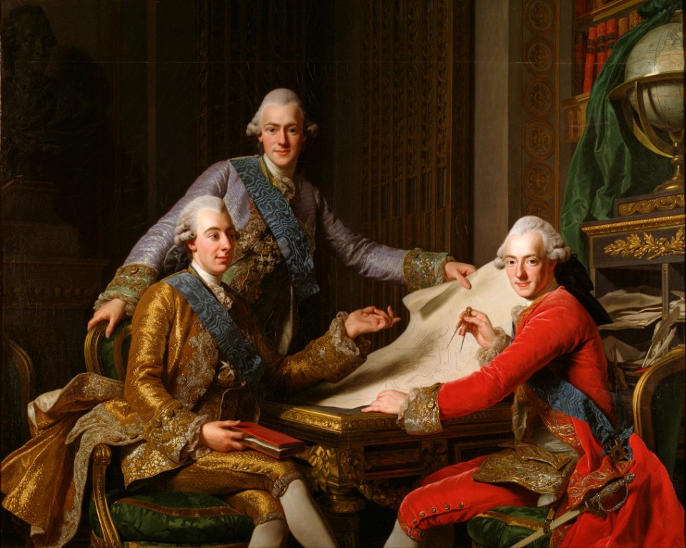
king gustav iii of sweden and his brothers (alexander roslin - nationalmuseum stockholm)
rococo
overwintering on nova zembla by willem barentsz, 1596-1597
maps in the rijksmuseum amsterdam
itinerario (jan huygen van linschoten)
latin-language maps
overwintering on nova zembla by willem barentsz, 1596-1597
maps in the rijksmuseum amsterdam
19th-century satirical maps
1899 maps of europe
norway, sweden, and denmark- with excursions to iceland and spitzbergen; handbook for travellers (1909)
maps of skansen
itinerario (jan huygen van linschoten)
latin-language maps
christina of sweden
rené descartes
itinerario (jan huygen van linschoten)
latin-language maps
17th-century maps of estonia
old maps of latvia
1900 maps of russia
1900 maps of china
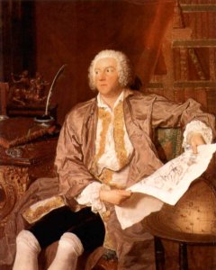
lorens pasch the younger
rococo
eric (xii) of sweden (erik magnusson)
maps of the history of sweden
count carl gustaf tessin (nm 5535)
rococo
historical coats of arms of denmark
ships on maps
18th-century maps of the baltic sea
1770s maps of sweden
1720 in sweden
1774 in sweden
maps of uppland
1645 in sweden
maps of the history of sweden
1386 in sweden
atlas van der hagen (volume 1)
atlas van der hagen
maps in the national archives of sweden
erik dahlbergh
jakobsbergs gård, järfälla municipality
maps of järfälla
maps of the history of sweden
maps of the kalmar union
17th-century maps of europe
latin-language maps
old maps of visby
pehr arvid säve
maps of the history of sweden
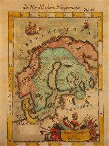
old maps of scandinavia
maps of islands of sweden
björkö
maps from the earth and its inhabitants, vol. v
maps of railway lines in norway
maps in the national archives of sweden
carl gustaf gillberg
maps of lidingö
1781 in sweden
maps of ven (oresund)
old maps of skåne
old maps of the nordic region
1840 maps
maps in the national archives of sweden
erik dahlbergh
photographs by lars kennerstedt
drawings in kulturmiljöbild
victor levasseur - maps of the world
coats of arms of switzerland
maps of lidingö
1774 in sweden
atlas van der hagen (volume 1)
atlas van der hagen
atlas maior, vol 2 (sweden, russia, poland, eastern europe, and greece) - joan blaeu, 1667 - bl 114.h(star).2
17th-century maps of scandinavia
den danske hærs historie til nutiden og den norske hærs historie indtil 1814
maps from the mechanical curator collection
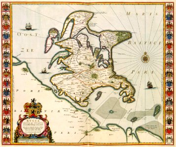
suecia antiqua et hodierna, volume 1
17th-century maps of sweden
17th-century maps of sweden
1660s maps of norway
historical images of bieraście
erik dahlbergh
church exteriors in sweden
vrigstads rivna kyrka
1656 in berlin
1656 maps
maps in the library of congress
1870 cartoons
göteborg harbour
nya varvet
atlas maior, vol 2 (sweden, russia, poland, eastern europe, and greece) - joan blaeu, 1667 - bl 114.h(star).2
17th-century maps of estonia
atlas maior, vol 2 (sweden, russia, poland, eastern europe, and greece) - joan blaeu, 1667 - bl 114.h(star).2
1667 maps of russia
atlas maior, vol 2 (sweden, russia, poland, eastern europe, and greece) - joan blaeu, 1667 - bl 114.h(star).2
17th-century maps of scandinavia
hummelmora torp
hummelmora hage
17th-century maps of finland
1680s maps of norway
maps from the mechanical curator collection available to georeference
maps from the mechanical curator collection
maps of denmark by gerardus mercator
historical coats of arms of denmark
maps of helsingborg by braun & hogenberg
maps of lund by braun & hogenberg
maps of islands of sweden
björkö
charles xi of sweden in art
description de l'universe
atlas maior, vol 2 (sweden, russia, poland, eastern europe, and greece) - joan blaeu, 1667 - bl 114.h(star).2
1667 maps of russia
christmas and winter scenes from the british library mechanical curator collection
christmas in norway
maps by wilhelm maximilian carpelan
slättens gård, mälarhöjden
atlas maior, vol 2 (sweden, russia, poland, eastern europe, and greece) - joan blaeu, 1667 - bl 114.h(star).2
17th-century maps of prussia
atlas maior, vol 2 (sweden, russia, poland, eastern europe, and greece) - joan blaeu, 1667 - bl 114.h(star).2
old maps of macedonia
russo-turkish war (1877–1878) in art
great eastern crisis (1875–78)
coats of arms of sweden and poland (personal union)
details of sigismund's map of moscow
atlas maior, vol 2 (sweden, russia, poland, eastern europe, and greece) - joan blaeu, 1667 - bl 114.h(star).2
17th-century maps of finland
atlas maior, vol 2 (sweden, russia, poland, eastern europe, and greece) - joan blaeu, 1667 - bl 114.h(star).2
1667 maps of russia
maps from the earth and its inhabitants, vol. v
19th-century maps of scandinavia
maps from the earth and its inhabitants, vol. v
1870s maps of norway
david rumsey historical map collection
old maps of the holy roman empire
atlas maior, vol 2 (sweden, russia, poland, eastern europe, and greece) - joan blaeu, 1667 - bl 114.h(star).2
17th-century maps of hungary
atlas maior, vol 2 (sweden, russia, poland, eastern europe, and greece) - joan blaeu, 1667 - bl 114.h(star).2
17th-century maps of greece
atlas maior, vol 2 (sweden, russia, poland, eastern europe, and greece) - joan blaeu, 1667 - bl 114.h(star).2
magni ducatus lithuaniae
atlas maior, vol 2 (sweden, russia, poland, eastern europe, and greece) - joan blaeu, 1667 - bl 114.h(star).2
17th-century maps of romania
atlas maior, vol 2 (sweden, russia, poland, eastern europe, and greece) - joan blaeu, 1667 - bl 114.h(star).2
maps of candia by ortelius and mercator
charles xi of sweden in art
description de l'universe
atlas maior, vol 2 (sweden, russia, poland, eastern europe, and greece) - joan blaeu, 1667 - bl 114.h(star).2
17th-century maps of the aegean sea
atlas maior, vol 2 (sweden, russia, poland, eastern europe, and greece) - joan blaeu, 1667 - bl 114.h(star).2
17th-century maps of poland
atlas maior, vol 2 (sweden, russia, poland, eastern europe, and greece) - joan blaeu, 1667 - bl 114.h(star).2
1667 maps of russia
chorographia bavariae
copper engraving
atlas maior, vol 2 (sweden, russia, poland, eastern europe, and greece) - joan blaeu, 1667 - bl 114.h(star).2
copper engraving print
atlas maior, vol 2 (sweden, russia, poland, eastern europe, and greece) - joan blaeu, 1667 - bl 114.h(star).2
copper engraving print
atlas maior, vol 2 (sweden, russia, poland, eastern europe, and greece) - joan blaeu, 1667 - bl 114.h(star).2
1667 maps of russia
atlas maior, vol 2 (sweden, russia, poland, eastern europe, and greece) - joan blaeu, 1667 - bl 114.h(star).2
1667 maps of russia
atlas maior, vol 2 (sweden, russia, poland, eastern europe, and greece) - joan blaeu, 1667 - bl 114.h(star).2
17th-century maps of the aegean sea
atlas maior, vol 2 (sweden, russia, poland, eastern europe, and greece) - joan blaeu, 1667 - bl 114.h(star).2
maps of slavonia by gerardus mercator
atlas maior, vol 2 (sweden, russia, poland, eastern europe, and greece) - joan blaeu, 1667 - bl 114.h(star).2
copper engraving print
david rumsey historical map collection
1794 maps of the holy roman empire
david rumsey historical map collection
1790s maps of the holy roman empire
atlas maior, vol 2 (sweden, russia, poland, eastern europe, and greece) - joan blaeu, 1667 - bl 114.h(star).2
1667 maps of russia
atlas maior, vol 2 (sweden, russia, poland, eastern europe, and greece) - joan blaeu, 1667 - bl 114.h(star).2
copper engraving print
atlas maior, vol 2 (sweden, russia, poland, eastern europe, and greece) - joan blaeu, 1667 - bl 114.h(star).2
copper engraving print
atlas maior, vol 2 (sweden, russia, poland, eastern europe, and greece) - joan blaeu, 1667 - bl 114.h(star).2
copper engraving print
atlas maior, vol 2 (sweden, russia, poland, eastern europe, and greece) - joan blaeu, 1667 - bl 114.h(star).2
copper engraving print
atlas maior, vol 2 (sweden, russia, poland, eastern europe, and greece) - joan blaeu, 1667 - bl 114.h(star).2
copper engraving print
chromolithographs in the rijksmuseum amsterdam
maps in the rijksmuseum amsterdam
1 - 100 of 134
Next page
/ 2